Doug McNeil, MD of Eolas Insight, said satellite technology can help humanity tackle the problems of conservation and the climate crisis.
Two Glaswegian start-ups are using satellite tech to help conservationists count African elephants from space. Glasgow-based Eolas Insight Ltd’s artificial intelligence and high-resolution satellite imagery can detect elephants roaming across vast areas of a national park in Southern Mozambique.
The Glasgow-based company has received funding from the European Space Agency (ESA) for the project. It is working with conservationists from the Peace Parks Foundation and fellow Glasgow tech start-up Omanos Analytics.
Omanos Analytics uses downstream satellite data analysis and on-the-ground intelligence to improve transparency and reduce risk around the social and environmental impacts of critical infrastructure projects.
Eolas Insight is a previous participant of Scottish accelerator program, CivTech. The scheme focuses on innovation in the public sector. The current conservation tech project is based on previous projects the start-up did with NatureScot as part of the CivTech Accelerator Program in 2020. That project used similar satellite imagery techniques to monitor Scotland’s wild red deer.
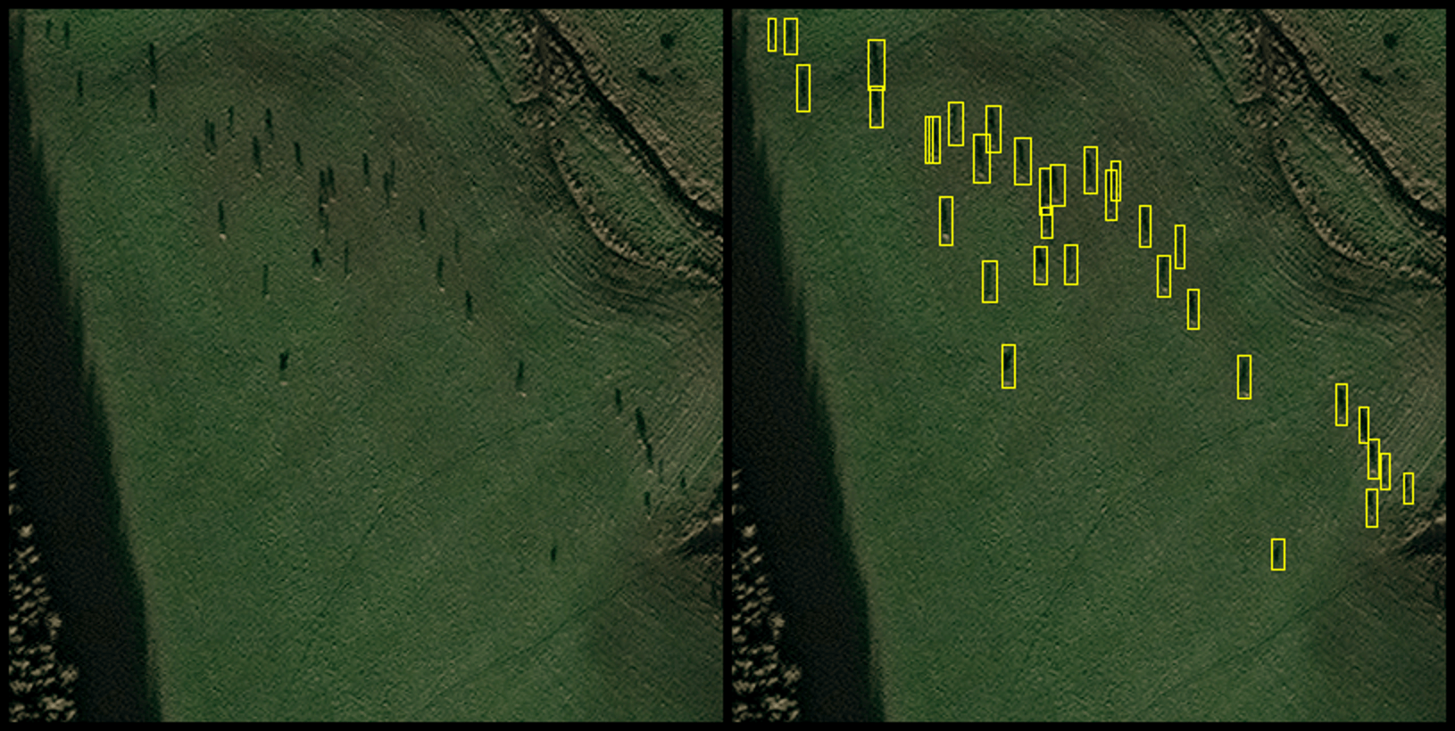
Satellite image tracking Scottish deer. Image: Eolas Insight
Not only will satellite technology help monitor threatened species across the world, it can also provide a more sustainable and cheaper alternative to helicopter-based counts. Satellites can pick up data on elephants such as how vulnerable they are in their environment. The technology can be used in remote areas as it does not depend on people on the ground. It can be used safely by anti-poachers too.
“Technology can play a key role in tackling what is arguably the biggest challenge facing mankind – conservation and the climate crisis. Detecting animals in satellite imagery will have its place in preservation projects of the future,” said Doug McNeil, managing director of Eolas Insight.
McNeil added that in the future his company would be working on creating a web-based platform for allowing users direct access to its methodology algorithms.
“There are so many hugely powerful new technologies available for environmental professionals and ecologists, however accessing these technologies can be a job in itself. At Eolas we want to take the complexity out of technology and provide invaluable information to our customers. Our hope is that we can help them in some small way in their hugely important and timely work,” he concluded.
10 things you need to know directly to your inbox every weekday. Sign up for the Daily BriefSilicon Republic’s digest of essential sci-tech news.